
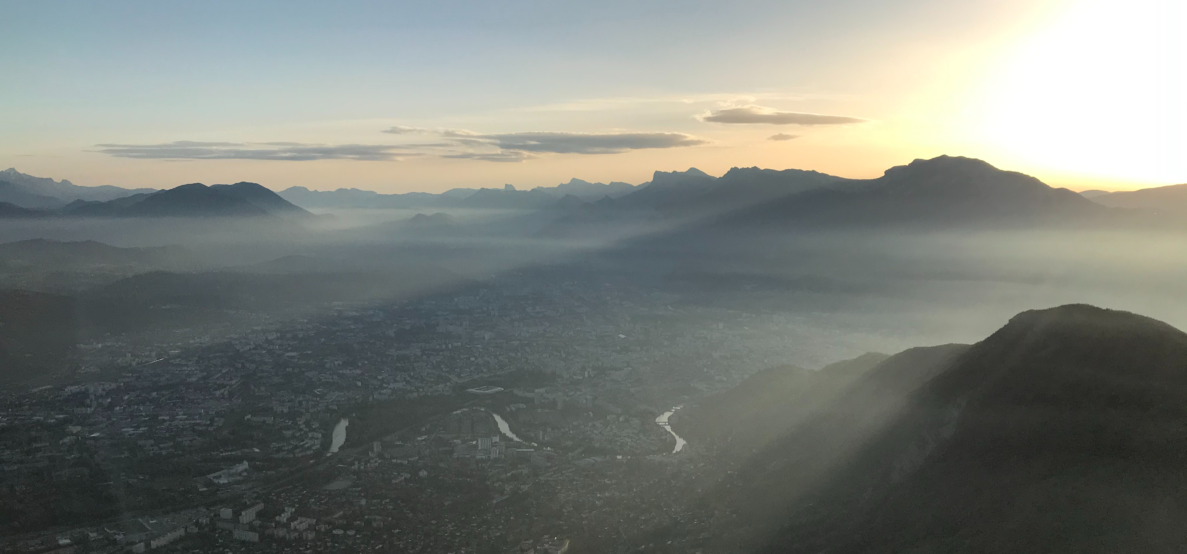
Chartreuse Natural Park is one of the four massif surroudings Grenoble (with Vercors, Belledone and Taillefer). It is a piece of nature where hikers, cyclists, and pragliding share this protected Park. Chartreuse is especially famous because its proximity from Grenoble and Lyon. It is easy to go there to spend a memorable time in the mountains, both in the winter and summer time. This park proves also that you do not have to go high to sweat and put a lot of energy in order to reach a beautiful the summit. Even if it is the lowest massif around Grenoble (Chamechaude only reach 2082 meters elevation), this park hide many technical hiking paths.
Through this article, I will try to give you the best tools in order to make your visit unique. I will advice what I think are the best daily-hike in the Park. The first spots that will appear will be the one I prefer the most.
How to go to Chartreuse Natural Park?
1- By Bus
If you do not have a car in Grenoble, you will obviously do not have this freedom to go wherever you want in order to hike the mountain of your choice. Nevertheless, some bus are going straight to the Park in order to satisfy every mountain lovers.
– Bus 62 (from Grenoble’s Museum to Col de Porte). This one is perfect if you want to hike Chamechaude, Pinéa or Charmant Som.
https://www.tag.fr/ftp/fiche_horaires/fiche_horaires_2014/HORAIRES_62.pdf
– Cars Région Auvergne Rhône Alpes. You will find many local bus that can drive you to the mountain, everything is on the website below:
https://carsisere.auvergnerhonealpes.fr/fr/itineraires/4/JourneyPlanner
2- By Car
Roads in Chartreuse are in a good state. You can reach any spot with a standard vehicule. Your GPS will not be lost, trust it.
What should you know before to go to Chartreuse Natural Park ?
- Numbers: Chartreuse’s Regional Natural Park is listed since 1995, there are 76 700 hectares and 60 000 people lived in the Park.
- Regional: this Park is listed as a Natural Regional Park, it means that you cannot do whatever you want during your visit.
- Summit: Chamechaude is the highest mountain of Chartreuse, 2082 meters.
- Fires / Barbecue: forbidden.
- Camping: you can bivouac in the mountain for one night at the same place.
- Dogs: they are not allowed everywhere. It depends also of the season (based on the hunting, alpine pasture, etc).
https://www.parc-chartreuse.net/decouvrir-la-chartreuse/la-chartreuse-en-partage/les-chiens/ - Food: across Chartreuse, you will be able to find many spots in order to share a nice lunch (or diner in the Park). Be careful because many restaurants are not open in the winter.
What are the best daily-hike in Chartreuse?
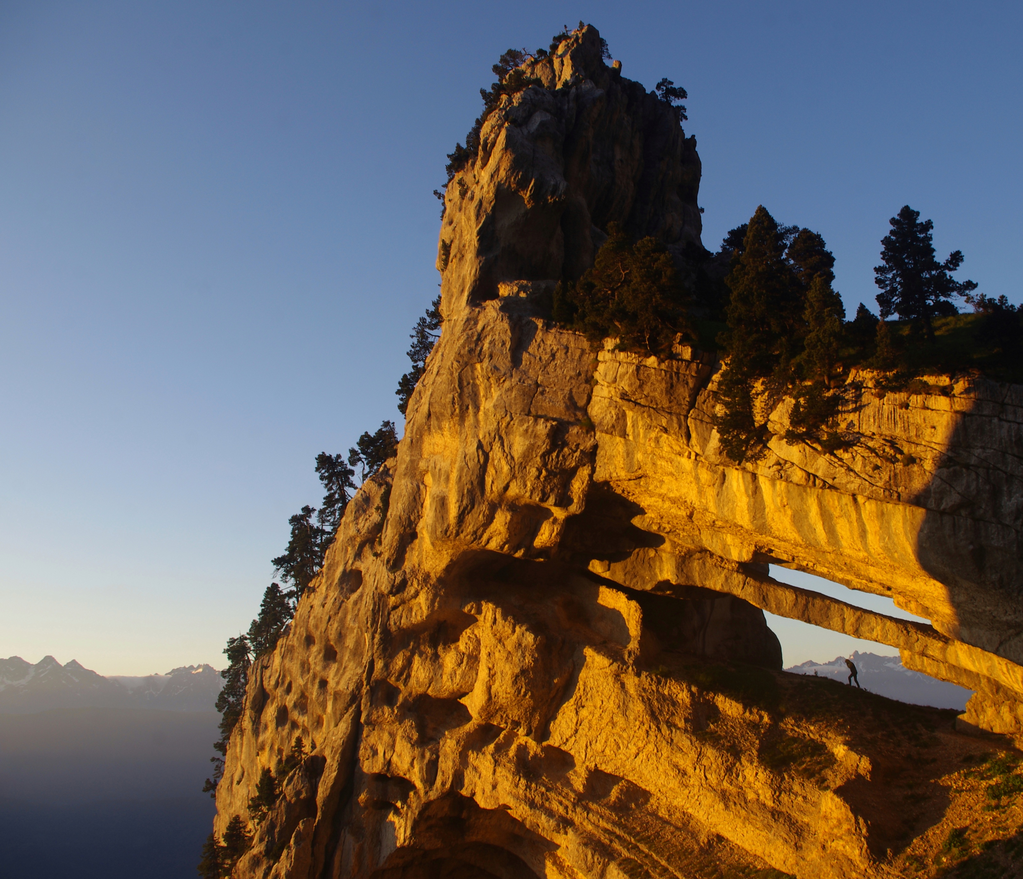
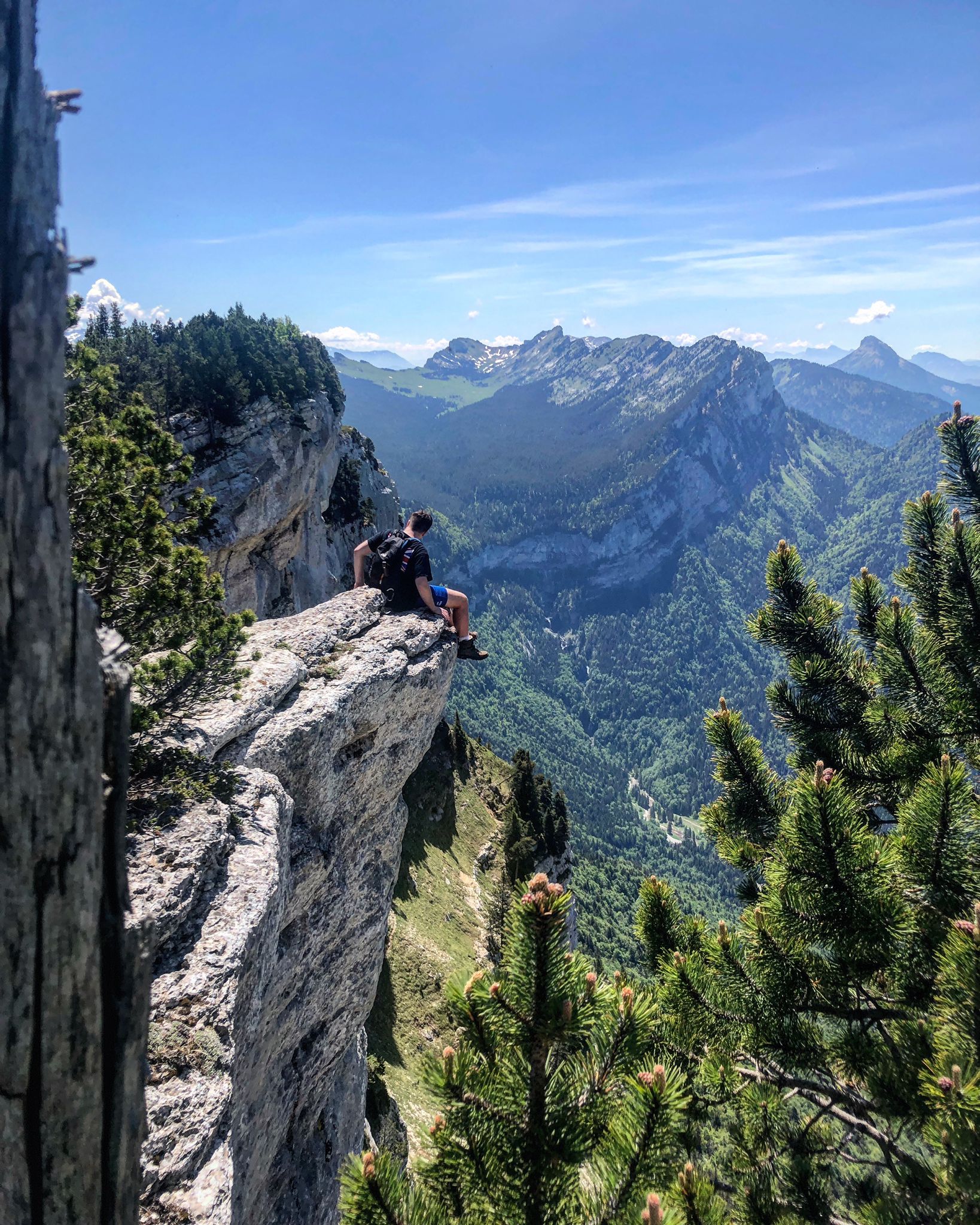
Tour Percée/Isabelle
I am strarting this guide with the most hearthbreaking spot of the Park. This arch higher than 30 meters is recently know as the biggest and one of the most secret place of the Alps. Well, it might not be anymore a secret as it is nowadays an hiking goal in social network. However, be aware that this place has only been discovered in 2006.
- Starting elevation: 1 066 meters from Col de Marcieu
- Tour Percée elevation : 1 926 meters
- Total ascending elevation : 860m D+
- Time : one way 3h (it is easy to do less)
- Season : From May to end of September
- Recommendation : it is hard to find and never go when it is wet
- Guide: https://minewhile.com/2020/03/23/tour-percee-tour-isabelles-hike/
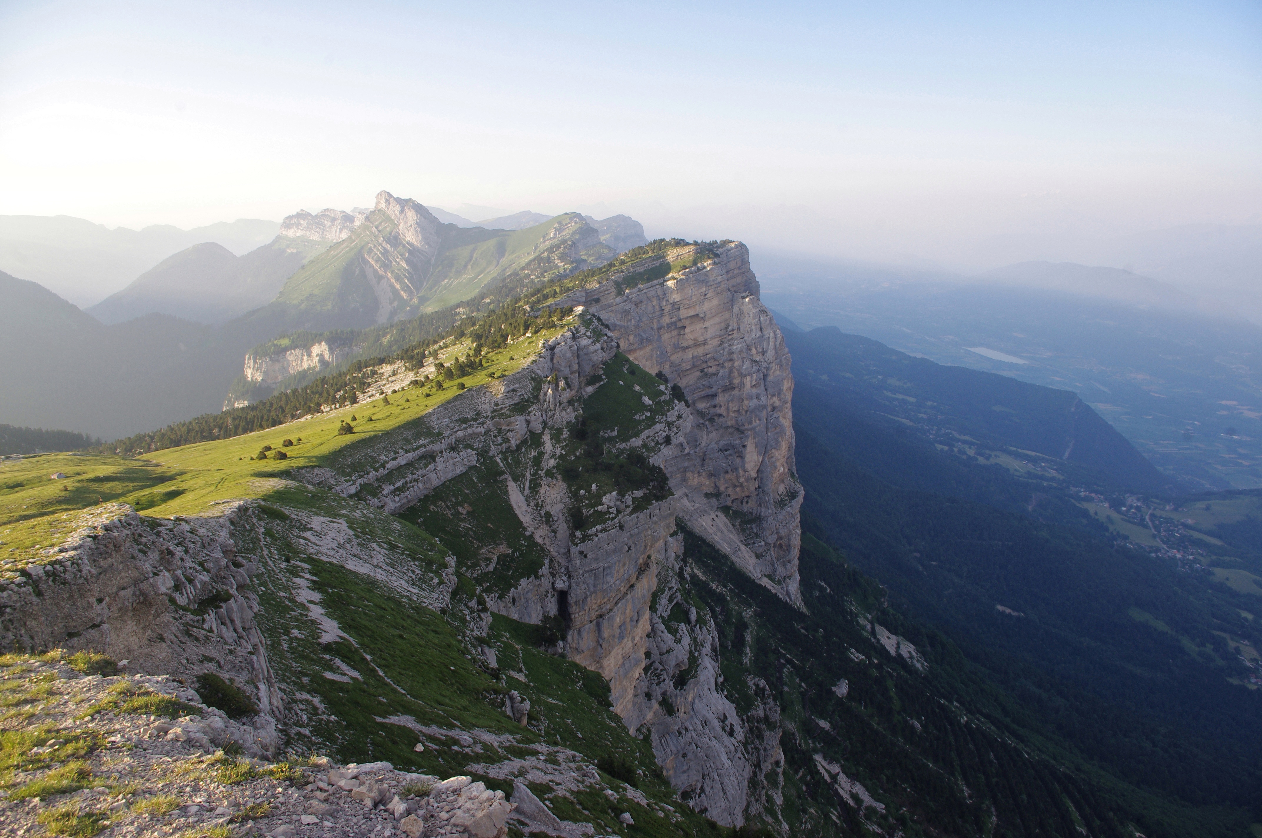
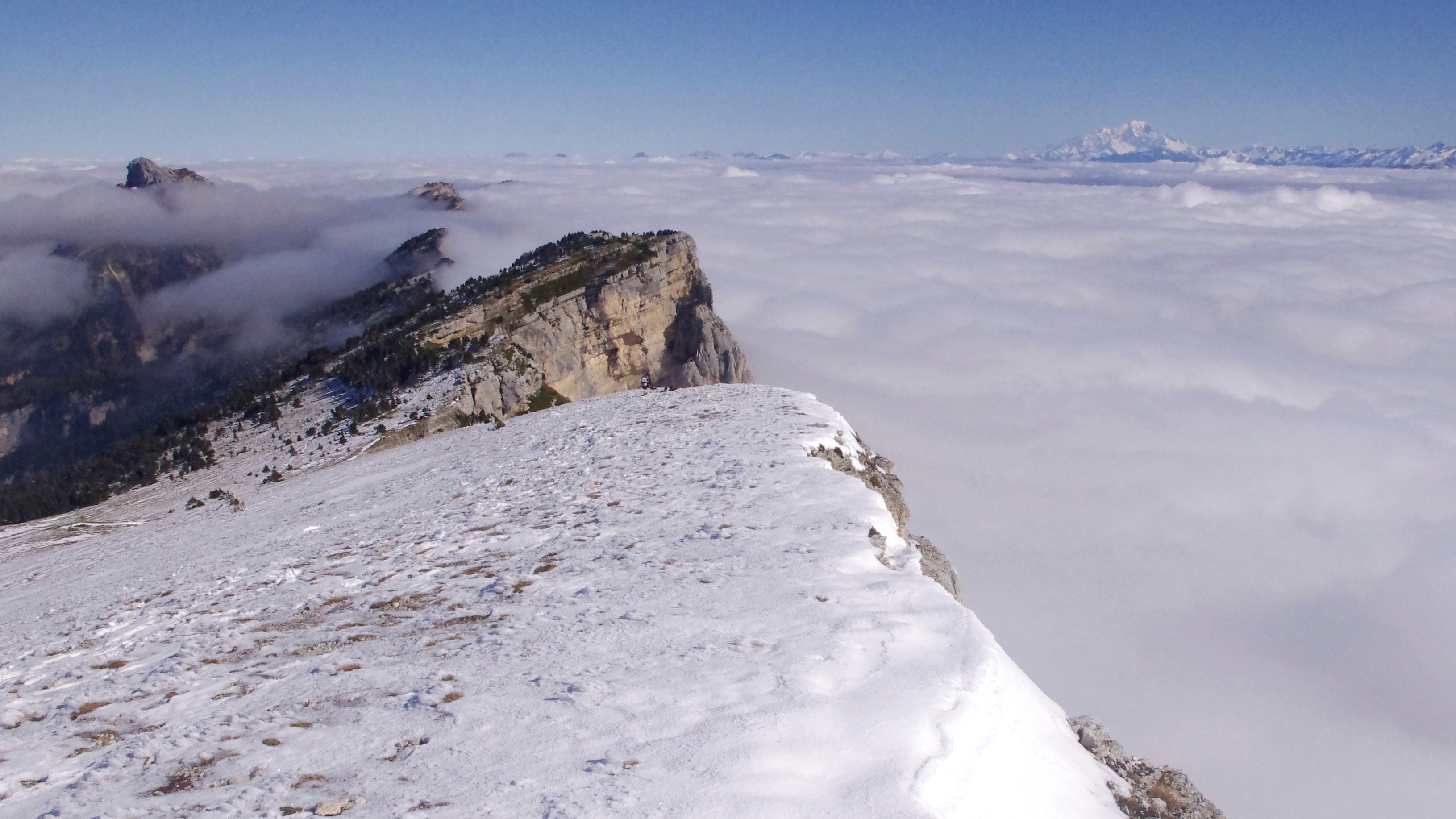
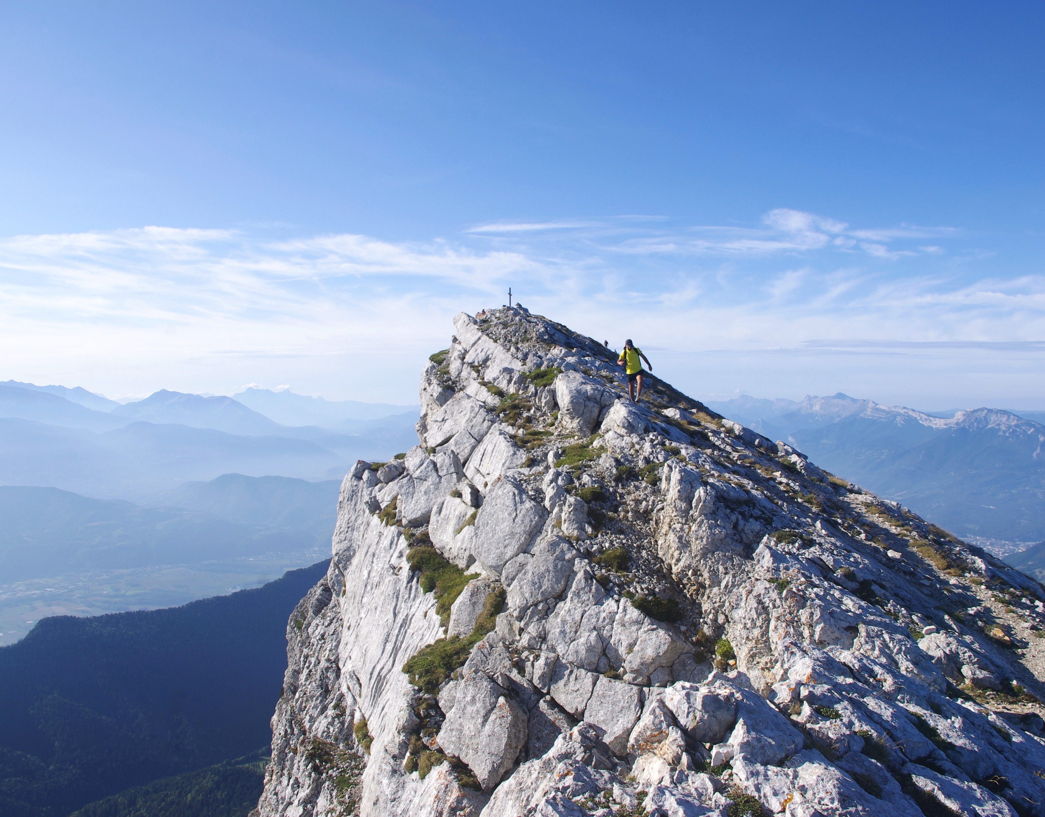
Dent de Crolles
One of the basics from Grenoble. There is, indeed, a reason to its success: it is extremely beautiful. I have never been bored to hike this mountain, and I have done it many times now. One of the advantage of this hike is that you can climb it by taking a different path on the way back. One of my recommandation would be to hike this mountain for the sunset. You will have incredible lights on the all the massif, you will even be able to watch Mont Blanc on the East.
- Starting elevation: 1 400 meters from Col de Coq
- Dent de Crolles elevation : 2 062 meters
- Total ascending elevation : 662 D+
- Best path: Pas de l’Oeille
- Time : one way 1h30 (it is easy to do less)
- Season : from mid-March to end-October. Winter hike are also possible with equipments.

Néron
BE CAREFUL – THIS MOUNTAIN IS DANGEROUS AND IT IS EASY TO BE LOST. From Grenoble, most of the people who wants to hike go to la Bastille, Mont Rachais or Chamechaude. Indeed, they are the easiest and the most famous hike close to Grenoble. Another peak which is really close from the city center is called “le Néron”. I would not advice any new hiker to go to this peak as it is really hard and technical. The path on the top is narrow and any mistakes can be dramatical. However, if you have the experience, it will give you one of the best view of Grenoble, I promise you.
- Starting elevation: 440 meters from Narbonne
- Néron elevation : 1 298 meters
- Total ascending elevation : 858m D+
- Time : one way 3h (it is easy to do less)
- Season : from May to end of September
- Recommendation : it is hard to find and never go when it is wet
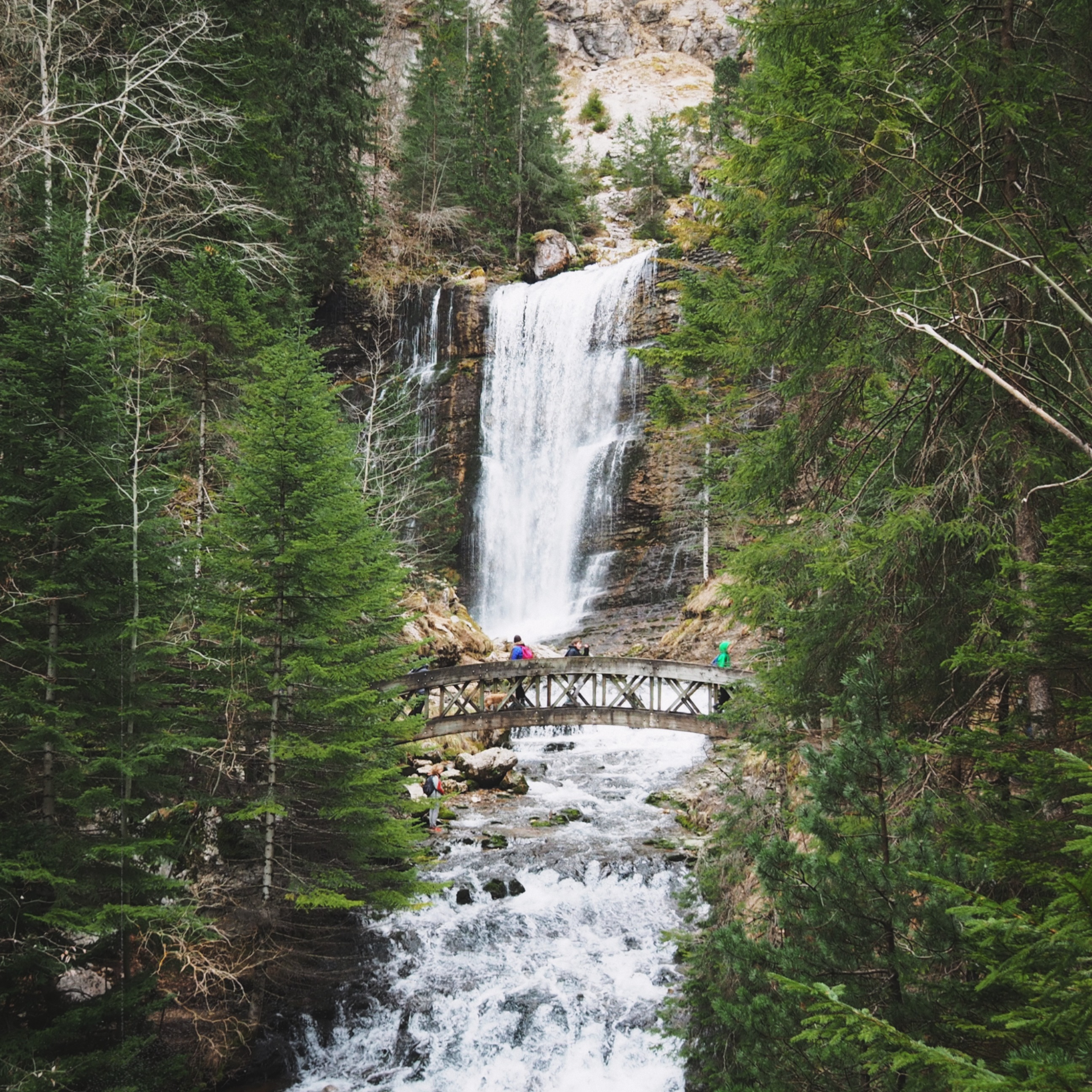
Cirque Saint-Même
Welcome to Canada. Well, I have never been to Canada but this place looks similar to what I can image from this country. Cirque de Saint-Même is not really a hike. Sorry for people who sold it like that, it is more walking in the woods with a bit of elevation. However, if it is on this list, it is because it is magnificent. If it had more elevation to see the waterfall, it could be ranked higher on the guide. If you want to walk more, you can also go above the waterfall and even higher to see the cliff (I have done it once, it was okay for a sport reason but the view was not as beautiful as the spots on this list).
- Starting elevation: 870 meters.
- Cirque Saint-Même elevation : 1 070 meters
- Total ascending elevation : 200 D+
- Time : one way 45 minutes (it is easy to do less)
- Season : all along the year
- Comments: parking is charged in the summer
Dôme de Bellefont
Based on a friend recommendation, Dôme de Bellefont has often been on the Chartreuse lover bucket list. I did not have yet the opportunity to go, however, this hike is a really great alternative and less touristic place than Dent de Crolles or Chamechaude. For a daily hike, my friend recommend you to join Lance de Malissard on the same day. It is few hundred meters on the North of Bellefont. Lance de Malissard permit you to join a 2000m peak, however, be careful it is a bit more technical.
- Starting elevation: 980m from Perquelin
- Dôme de Bellefont elevation : 1 975m.
- Total ascending elevation : 1 090m D+
- Time : two hours (easy to do less)
- Season : every season if you have equipment, otherwise, from end of March to end of October (simply depending on snow)
- Comments: do a short detour to Lance de Malissard (2045m)
Chamechaude
Finally, here is Chamechaude, the highest peak of the Massif. It is definitely a great hike, as you are on a top of Chartreuse and that the view is absolutely beautiful on the top. Except the elevation, you should not have difficulties to hike Chamechaude. Do not be surprised about the crowd. I spoke once with a guide who told me :”Chamechaude is the mountain where there is always someone at the top, in every season”.
- Starting elevation: 1 322 meters (Col de Porte)
- Chamechaude elevation : 2 082 meters.
- Total ascending elevation : 760m D+
- Time : one way 1h30 (it is easy to do less).
- Season : from April to end of October (winter hike is possible with equipments)
- Recommendation: go for sunrise or sunset to avoid the crowd
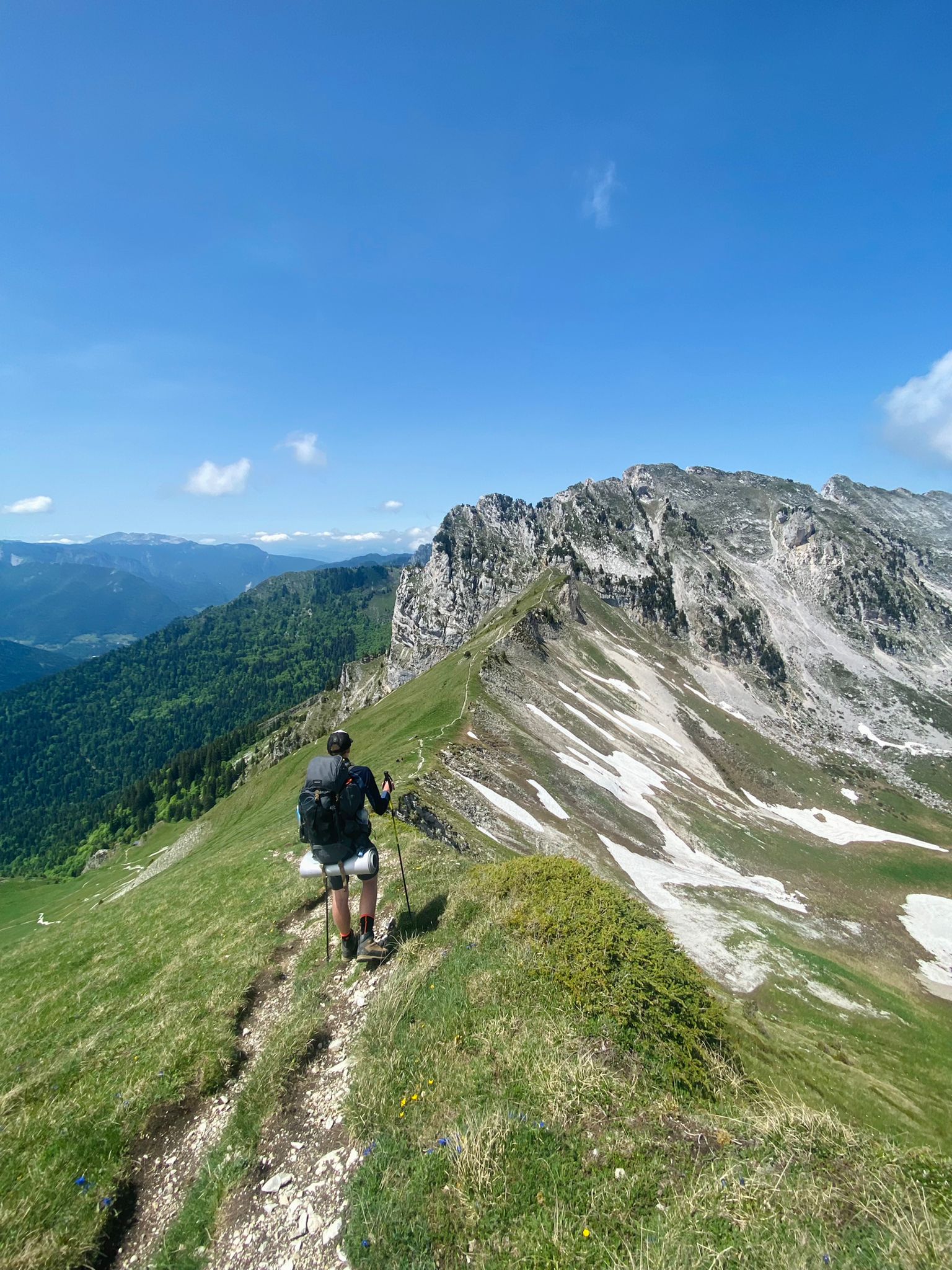
Le Pinet
Based on a friend recommendation that spend many time in the massif and who has also done the crossing of the massif by the cliffs, “Pinet” is one of its best hike in Chartreuse. This hike is loved by people because of its path which is elevated and close to the cliffs. Your hike has to go to “Sangles du Fouda Blanc” which is, definitely, the best itinerary to join the top. Here is a French link in order to have an idea of hike:
https://www.altituderando.com/Sangles-de-Fouda-Blanc-et-du-Pinet-en-boucle
- Starting elevation: 1 042m from Saint-Pierre d’Entremont
- Pinet elevation : 1 867 meters
- Total ascending elevation : 900m D+
- Time : two hours and a half (it is easy to do less)
- Season : from May to end of September (never hike Pinet with snow if you have no experience of winter hiking)
- Comments: follow the link for a more precise itinerary
Pinéa
Pinéa is always a great idea for a half a day hike. As there are different starts, this summit is a great alternative to bring people who are not comfortable with hiking. The start from Col de Porte has a bit a of elevation to the opposite of the start from Charmant Som parking where you approximately have 7km both ways for 350D+. As everytime, I really recommend to do the hike for a sunset or sunrise, mountains colors are just insane. You can also hike Pinéa during the winter season, however, you can only start from Col de Porte.
- Starting elevation: 1 330m from Col de Porte
1640m from Charmant Som Parking - Pinéa elevation : 1 771 meters
- Total ascending elevation : 440m D+ from Col de Porte
350m D+ from Charmant Som Parking - Time : one way one hour (it is easy to do less)
- Season : all along the year, be careful to the final ascension during winter time
- Comments: you cannot go to the Charmant Som Parking in the winter time
What are the best spot accessible by car in Chartreuse?
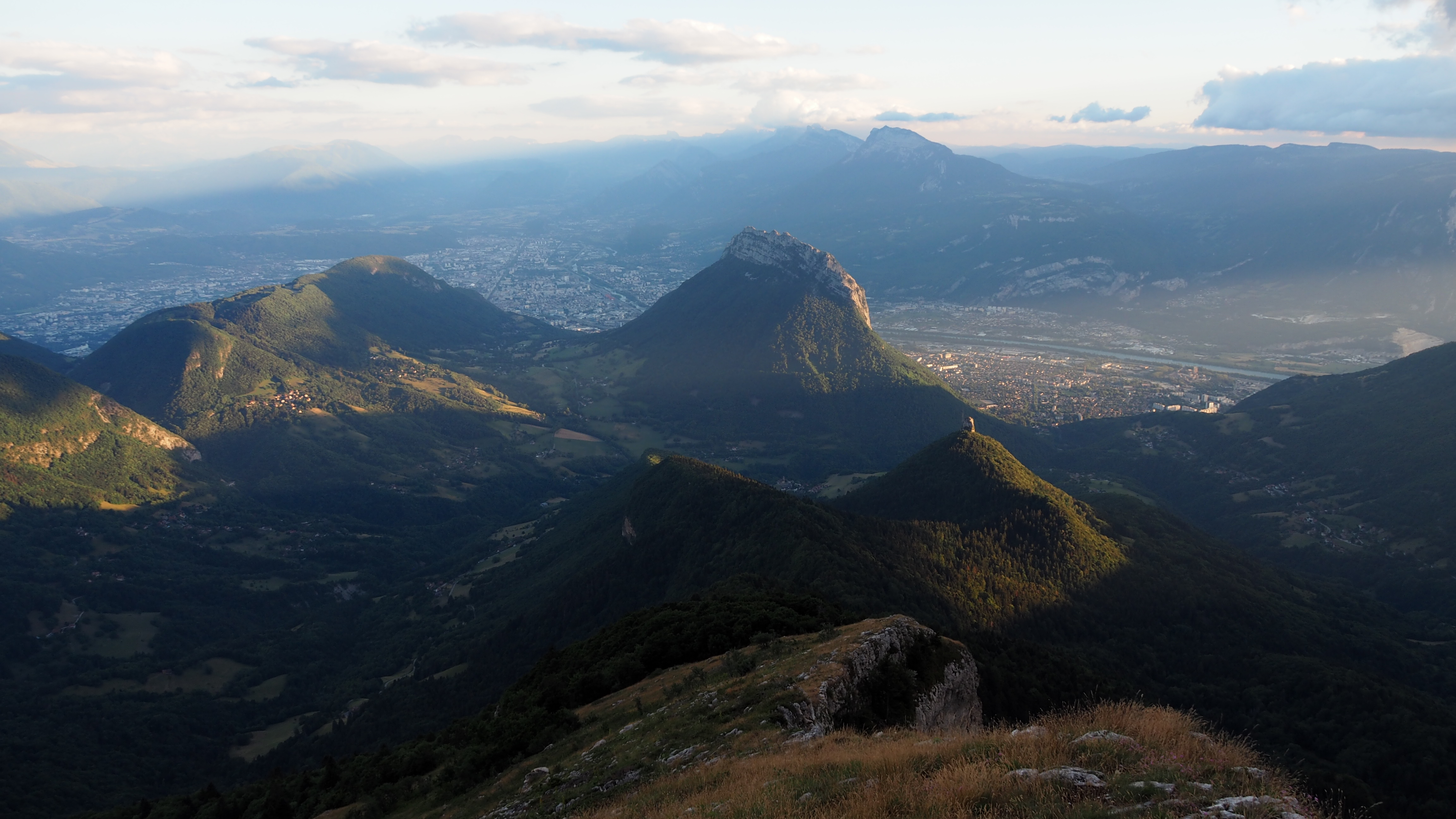
Fort du Saint-Eynard
This is, definitely, the best sunset/sunrise spot of the massif accessible by car.
Parking du Charmant Som
Great spot, open from mid-April to end of October (it just depends of snow). The panorama is insane and, if you are motivated, you can go on the top of Charmant Som, which is 200m D+ higher.
