Two years ago, in July 2018, my father, a friend and I decided to climb Aneto mountain, the highest peak you can find in French-Spanish boundary. Not that famous in France because of the Alps, Aneto has always been a goal for hiking enthusiasts based not far from Pyrénées. In order to compare Aneto to other “known” mountains in Europe, you can find below a standing in order to place Aneto:
- Mont Blanc – France : 4 810 meters (highest European peak)
- …
- Barre des Ecrins – France : 4 102 meters (10th highest French peak)
- …
- Teide – Canary Islands : 3 718 meters (highest Spanish peak)
- Mulhacen – Spain : 3 478 meters (2nd highest Spanish peak)
- Aneto – Spain : 3 404 meters (3rd and highest Pyrénées peak)
- …
- Vignemale – France : 3 298 meters (highest French side Pyrénées peak)
You can noticed that compared to other French or Spanish peaks, Aneto is far from the highest. Still, Pyrénées is a massif, even a well-known massif in Occidental Europe and climb the highest peak of a massif is always a challenge. Essentially above 3 000 meters.
Short context about our climb
Since 2009 and our move to Toulouse, my father and I climbed many mountains in order to discover Pyrénées. Starting from 2000 meters hike to 3000 meters as Taillon, Vignemale, Montcalm, Estates, etc… our objective has always been to train in order to climb the highest of Pyrénées: Aneto. In 2017, we had the will to do the hike and to pay for a guide in order to bring us to the top, however, the late season and the lack of ice and snow on the glacier stopped us in our ambitions. Indeed, you should climb this mountain when there is still an important amount of snow in the glacier, otherwise, your hike cannot be the one you expected. Thus, in 2018, our time finally arrived and we decided to reach the top by ourselves, taking all the considerations from our call with the guide the previous year. The 28th of July, my dad, Pierre (a long-time friend from handball and summer house) and I starting our climb to an unforgettable moment.
Aneto Hike Informations
- Parking : Benasque Hospital (Plata de la Serra)
- Starting Point : La Besurta (1 hour walk from Plata de la Serra)
- Starting Elevation: 1 890 meters
- Aneto Elevation: 3 404 meters
- Total positive Elevation : 1 720 meters
- Time : Around 12 hours from la Besurta if you are a regular hiker (go and come back)
- Season : End of spring, start of summer. August starts to be too late.
- Mandatory Equipment : cleat/stud (crampons in French), quality hiking shoes, ice axe, helmet, head light, rope.
- Recommandations : If you are afraid of heights, be careful, some paths are sloping.
- Snacking : You can find food and drinks in La Rencluse shelter (only cash).
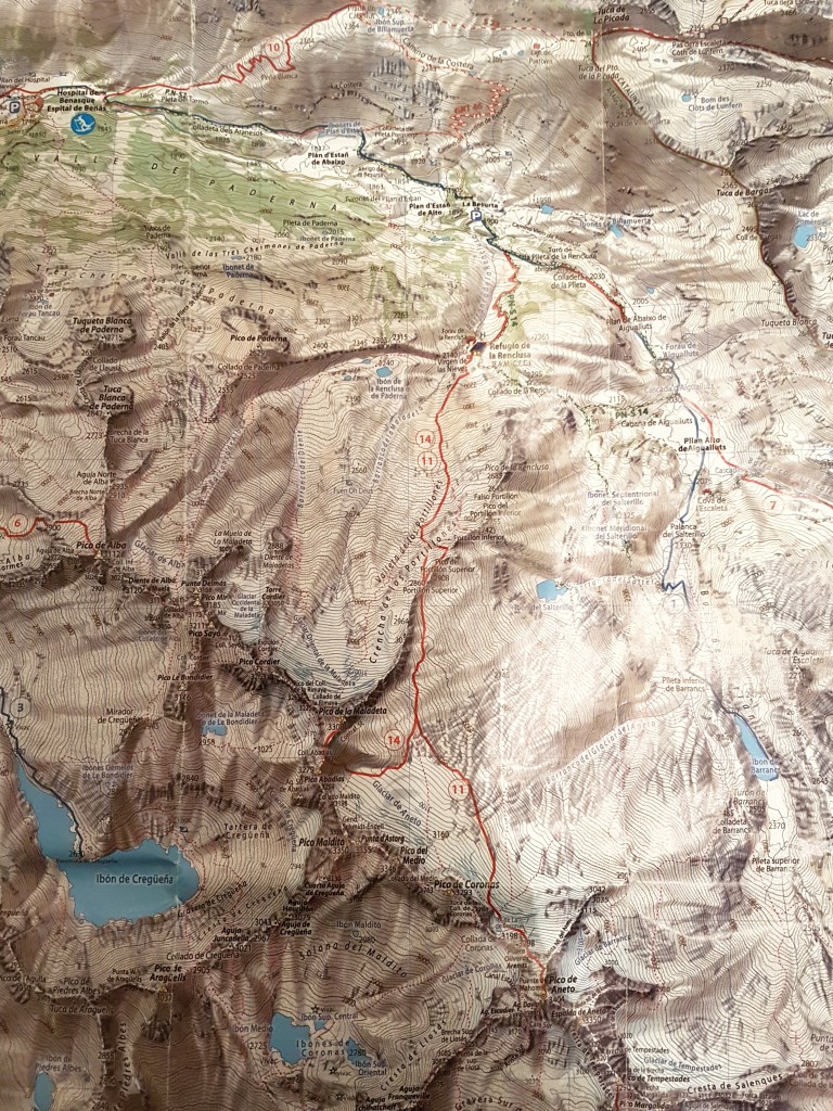
- Map : See in Appendice.
Hiking Itinerary
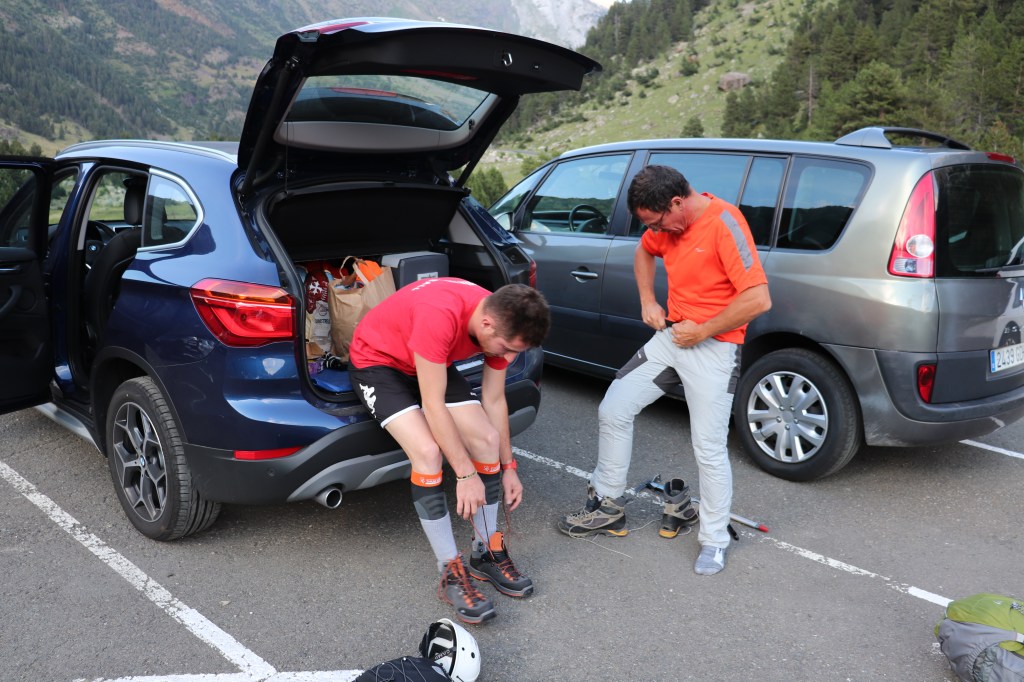
Starting from Toulouse, the road to Spain and to Benasque, the last village before the hike, is long. Thus, our crew decided to leave Toulouse the day before the hike, the 28th of July, and to drive 3 hours and a half in the afternoon. We parked to Benasque Hospital (Plata de la Serra) and then walked until la Rencluse shelter at the end of the afternoon. It took approximately one hour and a half in order to reach the shelter. This way has to be taken into account as there is a long part on a road where cars cannot access. There is a bus in order to do this long and useless part every 30 minutes, however, have a look to the timetables because at the end of the day there were none.
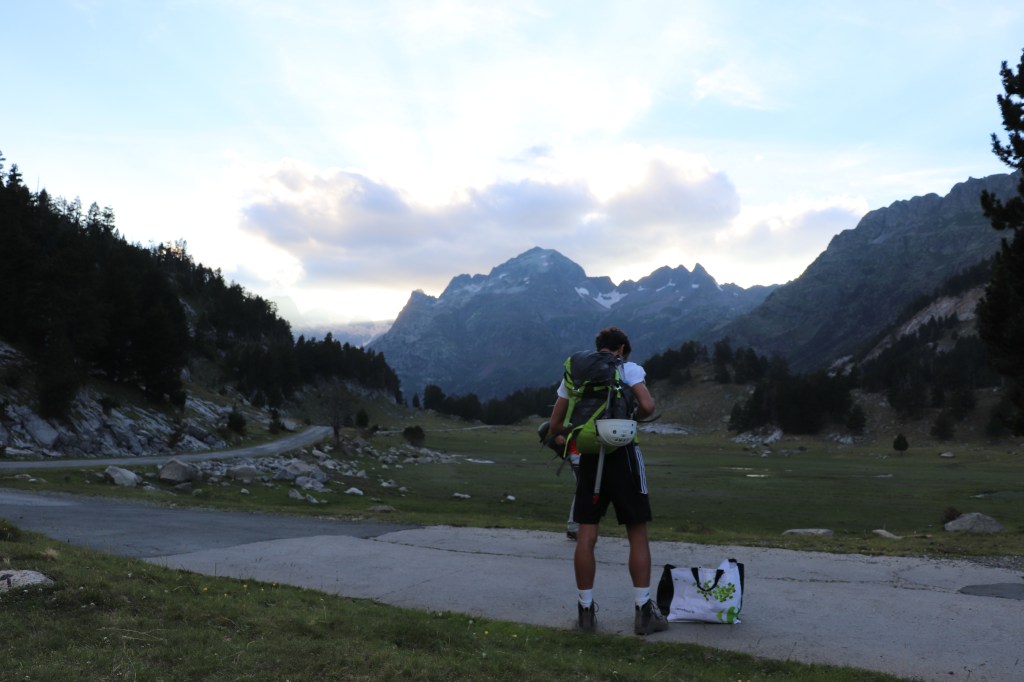
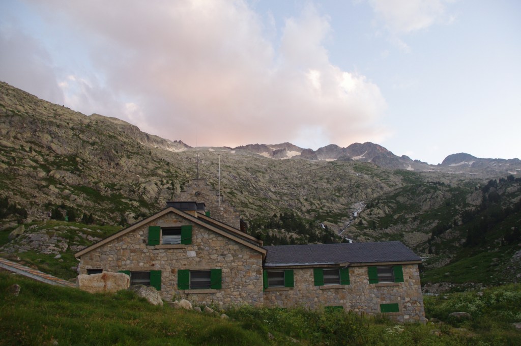
La Rencluse shelter is easy to reach and there are many signals on the path in order to find it. Forty minutes later from la Besurta, we arrived and decided to set up our tent next to the shelter. We ate food that we brought from Toulouse and enjoyed our short night with a sky full of stars without any lights pollution.
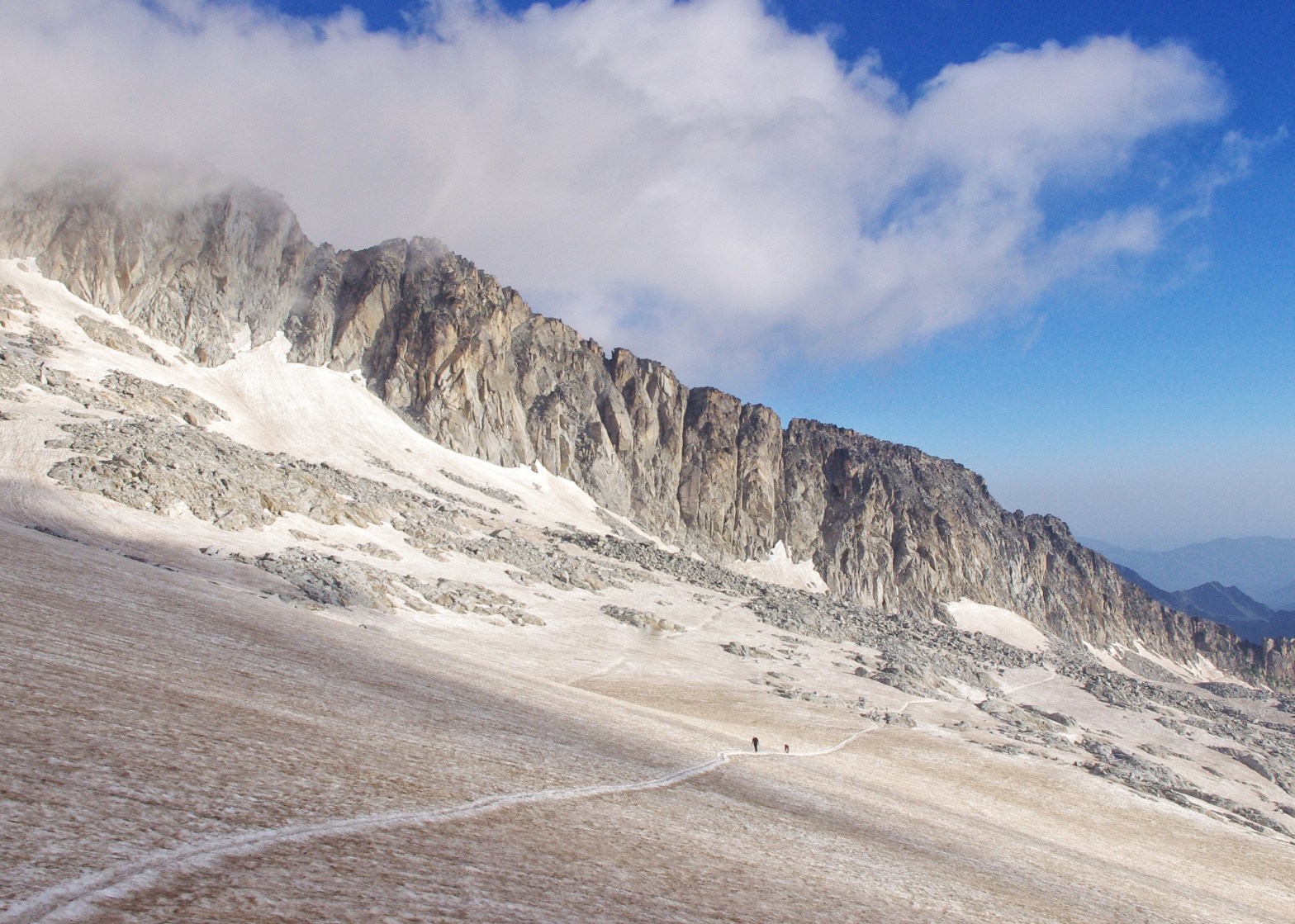
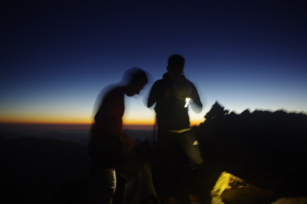
The 29th of July, our alarm rings at 03h30am. Yeah, that’s early on the moment but you feel emotions when you can watch the sunrise from a high point of view. Anyway, we took some food and drunk our coffee thanks to our portable stove then started the hike by night. The path is well marked with a lot of signals on the rocks. At this season, there is no snow anymore and you can “easily” find the right path. By night, you just need to be careful of those signals and take the time to go on the right direction if you have any doubt. Thus, even if the path is elevated and you walk most of the way on the rocks, it is not that hard to join the Portillon Superieur (kind of breach). There is just one tricky thing which is a bit dangerous. You can decide to join Portillon Superieur by the ridge in order to have a great view with an incredible sunrise, or to stay a bit lower in order to do not take risk and reach the Portillon breach in an easier way.
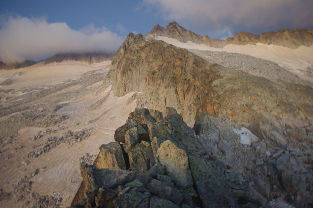
From Portillon Supérieur, you just have to walk down about 100 meters in order to join the glacier and to install your clead/stud and catch your ice axe. The importance to climb Aneto early in the year is the snow. Indeed, as Aneto glacier “starts” to be smaller, many rocks passage appears. It means that you have to set up, then take off your clead/stud many times. I guess that during our hike we did that approximately four times. That’s boring. Furthermore, I can read on many guides that rope is highly recommended. Well… rope is ALWAYS a security tool, you never know what is going on glacier. However, to be honest, the path on the glacier is easily recognizable and it looks safe. Still, let’s be prudent in mountains, I advice you to take a rope on your bag by safety because you never know what can happen. From the start of the glacier, you can see during the entire part of the way Aneto Peak.

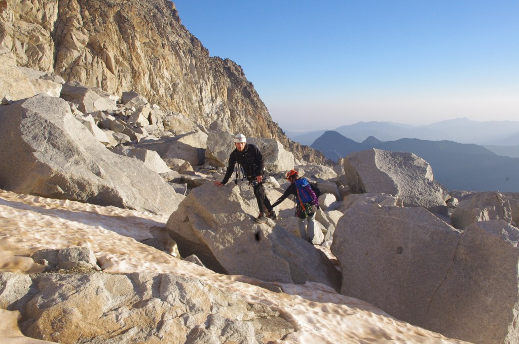
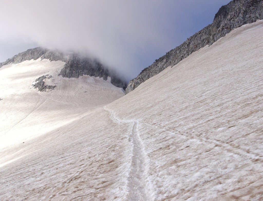
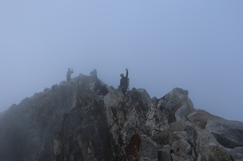
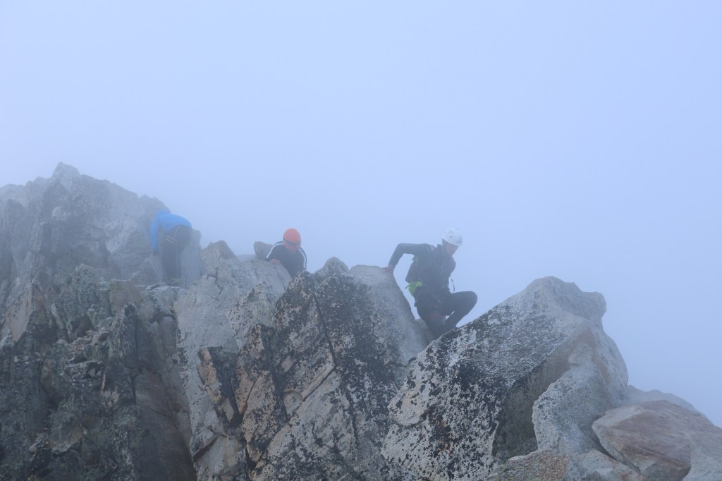
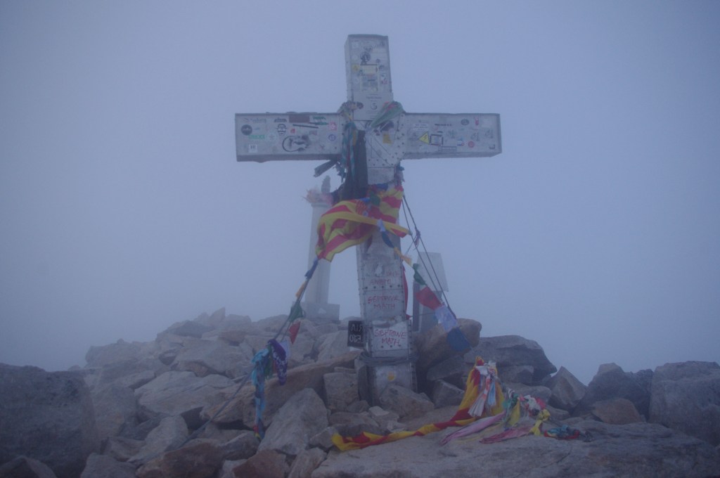
Few kilometers and an unforgettable ice walk later, you will arrive on a pass called Col de Coronas based at 3 200 meters. Few hundred meters later, you will finally join a busy and dangerous passage. This famous passage is often busy because it is highly dangerous, and only one people can go at each time. If there is a reason to go out your rope from you bag it could be here. Furthermore, if you are afraid of heights, I cannot recommend you to go, the emptiness from “Le Pas de Mahomet” (passage name) is really deep. After this last and not the easiest passage, you can see and finally touch the cross on the top of the Pyrénées. Congratulations, you are on the top of Aneto, the higher mountain in front of you is in the Alps or Grenada.
In order to go back to la Rencluse shelter and to la Besurta, you can simply take the same path than when you went up. With lights and sunshine, it will be easier to find you direction and to see the shelter from Portillon Superieur.
Appendice